|
|
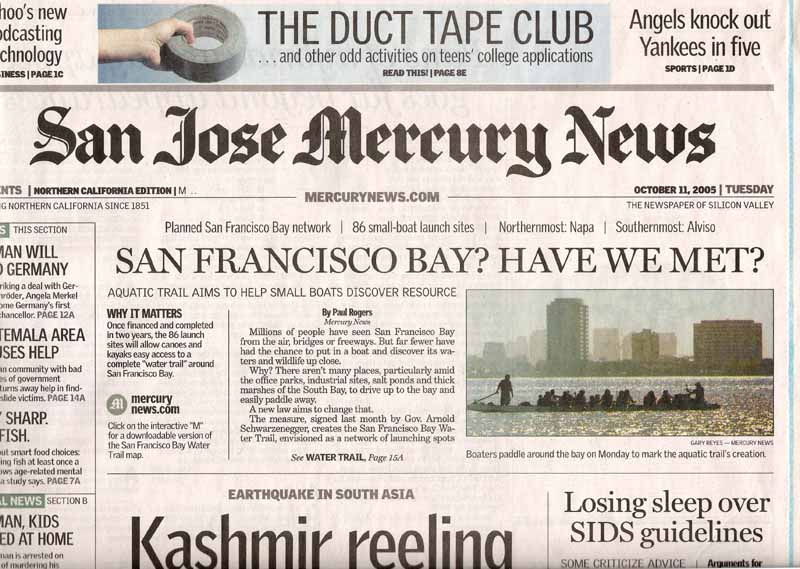
San Francisco Bay? Have we met?By Paul Rogers Mercury News Millions of people have seen San Francisco Bay from the air, bridges or freeways. But far fewer have had the chance to put in a boat and discover its waters and wildlife up close. Why? There aren't many places, particularly amid the office parks, industrial sites, salt ponds and thick marshes of the South Bay, to drive up to the bay and easily paddle away. A new law aims to change that. The measure, signed last month by Gov. Arnold Schwarzenegger, creates the San Francisco Bay Water Trail, envisioned as a network of launching spots for kayaks, canoes and other small boats. It calls for a plan to be drawn up by the state's Bay Conservation and Development Commission, highlighting places the public can easily access the bay, with Web sites, maps, coordinated signs and, in some cases, bathrooms, parking lots, campgrounds or links to hotels. There are 86 existing or planned launch areas that will probably be included when the plan is finished in two years. The law contains no money yet, but state park bonds, federal grants and donations will help with any needed construction, supporters say. Monday, about 25 kayakers paddled from the Berkeley Marina to San Francisco to celebrate the new law. Such trails already are popular in Maine, Puget Sound and along the Hudson River in New York. ``The bay is our biggest open space. Having places where people can get onto the water is important,'' said Penny Wells of San Rafael, a retired biochemist and kayaker who sits on the board of Bay Access, a group that sponsored the bill. Outdoors lovers say an aquatic trail could boost tourism, educate the public about wildlife and expand understanding of the region's signature natural feature. ``In the North Bay, where people see the water, they seem to participate more with water sports,'' said J.J. Ganjei, owner of Outback Adventures in San Jose and Larkspur. ``But we have limited access around the South Bay. People here don't seem to have as much of a connection to the bay. People come up to me all the time and say, `Where do you go paddling?' And I think, `Are you kidding me?' There's plenty of places. People just don't know where they can paddle.'' Ganjei's business sells kayaks, gives lessons and offers trips to places like Angel Island and also to Bair Island, off Redwood City. There, for $85 a day, his guides take kayakers out to see harbor seals, egrets, herons and other wildlife. In the middle of the bay, there can be strong currents, fog, wind and large cargo ships. But along the shoreline -- where the trail will go -- there are plenty of calm spots where beginners can safely paddle, from the marshes of the South Bay up to Richardson Bay near Tiburon, he said. The governor signed the law, written by Assemblywoman Loni Hancock, D-El Cerrito, on Sept. 22. The 86 spots likely to be included in the plan feature locations from San Jose to Napa that are either existing launch spots, public beaches or proposed launch areas, such as the $5.5 million Alviso Marina set to open in 2007. Most are clustered around Berkeley, Richmond, San Francisco and Marin County, with South Bay locations in Palo Alto, Redwood City, the Dumbarton Bridge, Alviso and Dixon Landing near Milpitas. There's nothing to stop people in small fishing boats with motors from entering the water in those spots and following the signposts. But the focus will be on kayaks and canoes. Planners say they will work hard to keep the smallest boats out of trouble: shipping lanes, endangered species' habitat and Coast Guard and Navy facilities. ``We're going to figure out all the good routes,'' said Neal Fishman, deputy director of the California Coastal Conservancy, which will implement the final plan. ``Water trails are a major attraction in other parts of the country. Why not San Francisco Bay, too?'' Contact Paul Rogers at progers@mercurynews.com or (408) 920-5045. |